Hotairballoon Navigation
This app will assist you, as a hotairballoon pilot, to navigate your hotairballoon by helping to find the best wind. It does this by capturing heading and speed at all altitudes, while you fly, and remembers them. After this the tool can provide the information you need to choose the altitude for best heading or speed. Bounds where you are interested in, for example 500 to 1500 feet, can be set and you can request the best heading or speed for the selected range.
The information available:
- altitude of lowest heading
- altitude of highest heading
- altitude of lowest speed
- altitude of highest speed
- actual heading at a selected altitude
- actual speed at a selected altitude
- real time clock
- elapsed time since start button was pressed
- upper and lower altitude bounds can be selected
- speed can displayed in kilometres per hour or knots (tap on it to switch units)
- altitude can be displayed in feet or meters (tap on it to switch units)
- heading in true degrees
- view tracklog on map and email it as .gpx file for review in other apps.
LEFT and RIGHT pickers:
By using the most left or right picker you select the altitude range you are interested in. A yellow RANGE button indicates that the range you selected is in use. When this button has a blue colour the range is set to its default settings. Data collection is not influenced by these pickers.
CENTRE picker.
With the centre picker you select a specific altitude for what you need to know the heading and speed for. It works in combination with the range segmented switch. In case the range is for example set to 100 and the centre picker is set to 1000 feet the app will return the average heading and speed between 950 and 1050 feet. In case you select a range of 1 you can scroll to all captured heights and show results.
Running in the background:
The app can run in the background. By enabling this feature you allow the app to capture flight data while the screen is off. This to minimise batterie power consumption. When your device detects no movement or receives no GPS data for 30 minutes, while running the app in the background, it will disable the GPS location updates and therefore saves batterie power. You allow running in background using the "BG-ON/BG-OFF" switch. An orange colour of this switch indicates your app will continue running in the background.
Right bottom counter:
This count shows the number of captured altitudes for what we have data memory for review. For each altitude only the last captured data is remembered. Old values are discarded.
Left bottom time field:
This field shows the time of when the bottom info field, showing heading altitude and speed, was captured. This field is only shown after one of the bottom buttons (heading or speed +/-) was selected.
Top left time field:
This field shows your actual local time.
Top right time field:
This field show the elapsed time since the start button was pressed.
Graph view:
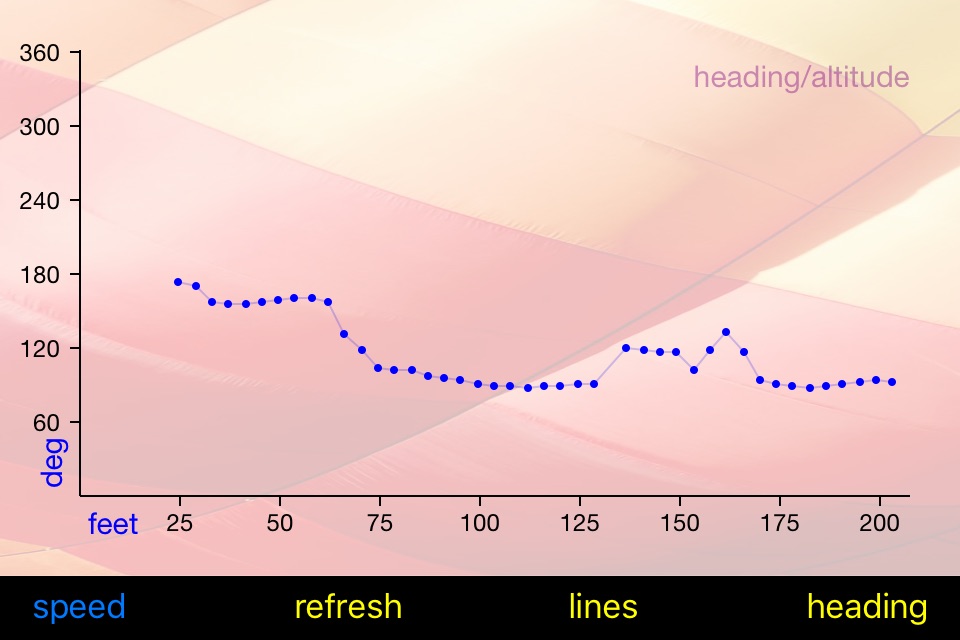
Swiping from left to right on your main screen will bring you to a graph view of your flight data. On this view you can select heading/altitude or speed/altitude to display your data graphically.
Map view:
Swiping from right to left or press the map button on the main screen to view your track. You can view both standard and satellite maps.
Notes:
To make the app work you must allow location services to allow the app to capture movement data. When pressing the "START" button the app will empty its list of captured data and then start capturing new data. The "RUNNING" indicator on the right-top button indicates the app is collecting data.
Remarks:
Use this app at you own risk. Always follow official navigation regulations. The app will increase battery consumption of your device as the GPS is constantly turned on while it is running.


